


Coordinate Plot
Description of Coordinate Plot
Coordinate Plot is a mobile application designed for professionals in the surveying field. This app streamlines the process of generating survey plans automatically, making it a valuable tool for those involved in land measurement and boundary determination. Available for the Android platform, users can easily download Coordinate Plot to begin utilizing its various features.
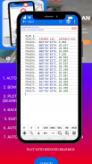
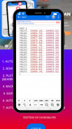
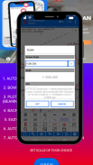
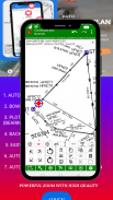
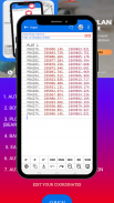
The application offers a comprehensive set of tools aimed at editing coordinates, bearings, and distances. Users can input specific data points to create accurate survey plans that are tailored to their needs. This function is particularly beneficial for surveyors who require precision in their work, enhancing the overall efficiency of the planning process.
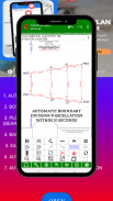
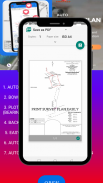
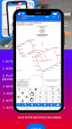
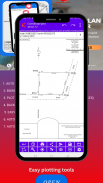
Plotting tools within Coordinate Plot allow users to create visual representations of survey data. These tools facilitate the plotting of land parcels and boundaries, enabling professionals to see their surveyed areas in an easily understandable format. The intuitive interface assists with quick navigation and operation, making it accessible for various users.
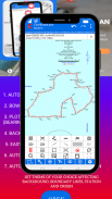
In addition to basic plotting, the app includes features for applying themes, scaling, and implementing plan titles and origins. This customization allows users to create professional-looking survey plans that can be easily shared with clients or stakeholders. The ability to adjust these features ensures that the final product meets specific presentation standards.
Road design tools are another aspect of Coordinate Plot that contribute to its functionality. These tools assist users in planning road layouts and designs, integrating this critical aspect of land surveying into the overall planning process. This feature is essential for professionals engaged in urban planning or infrastructure development.
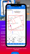
Automatic land parcelation and boundary division are significant time-saving features of the app. Users can quickly delineate land parcels without the need for extensive manual input, which can often be a time-consuming task. This automation enhances productivity, allowing surveyors to focus on other important aspects of their work.
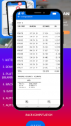
Furthermore, the app includes automatic area adjustment capabilities. This feature enables users to make necessary modifications to land areas quickly, ensuring that any changes in land use or boundaries can be accurately reflected in the survey plan. The efficiency of this function helps maintain the accuracy required in surveying tasks.
Coordinate Plot is structured to support both novice and experienced users. The intuitive design guides new users through the various functionalities, while experienced professionals can take advantage of the more advanced features without a steep learning curve. The app's user-friendly interface promotes an efficient workflow, making it suitable for a wide range of surveying activities.
The application is ideal for professionals who require a reliable tool for generating survey plans. Its features are designed to facilitate the entire surveying process, from initial data entry to the final output of a professional survey plan. The ability to edit and customize plans effectively makes it a versatile choice for those in the field.
With the capability to produce accurate survey plans rapidly, Coordinate Plot addresses a critical need among surveyors. The combination of plotting tools, editing capabilities, and automated features means that users can rely on the app to meet their surveying needs efficiently. This focus on productivity and accuracy is a significant advantage in the fast-paced world of land surveying.
The app fosters collaboration among surveyors, as the generated plans can be shared easily with colleagues or clients. This sharing capability enhances communication, ensuring that all parties involved have access to the necessary information for decision-making.
Coordinate Plot also supports various safety and regulatory standards in surveying. By maintaining high accuracy levels and providing reliable data, the app helps professionals adhere to the guidelines set forth in their respective fields. This compliance is essential for maintaining credibility and trust with clients and regulatory bodies.
In conclusion, Coordinate Plot presents a robust solution for professionals in surveying, combining essential tools for creating, editing, and customizing survey plans. Its user-friendly design, coupled with advanced features like automatic parcelation and area adjustment, streamlines the surveying process. The application empowers users to enhance their productivity while ensuring high-quality results in their surveying projects. Downloading Coordinate Plot provides access to a comprehensive suite of tools that cater to the diverse needs of land surveyors.
Coordinate Plot - Version MCAD 8.2
(27-02-2025)Coordinate Plot - APK Information
APK Version: MCAD 8.2Package: vlonn.coordinate_plot_freeLatest Version of Coordinate Plot
Other versions


Apps in the same category

You may also like...


